REAL-WORLD INTELLIGENCE
LIVE USE CASE SHOWCASE
Monitor infrastructure, environmental activity, urban growth, and major events using high-resolution satellite intelligence captured directly from orbit.
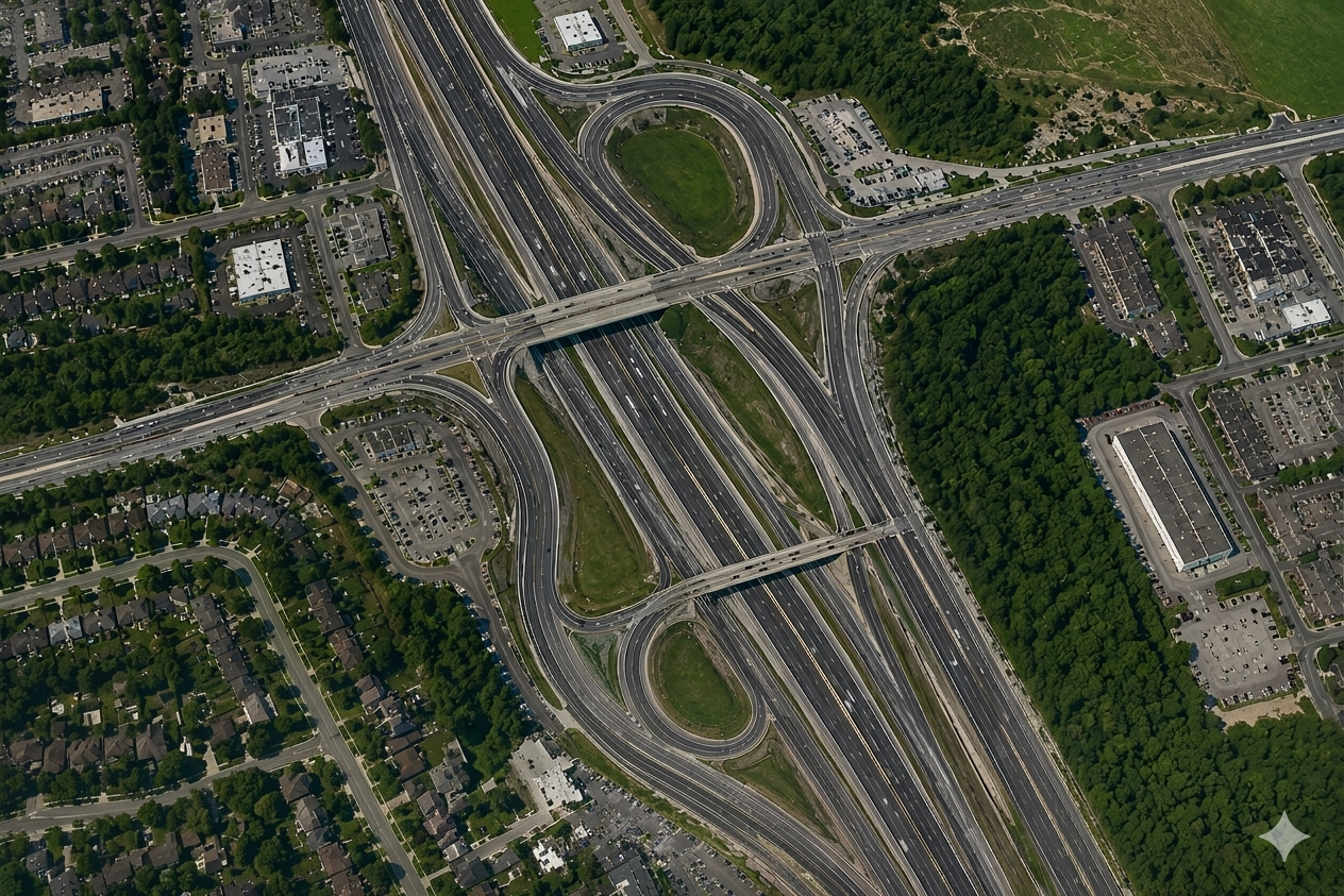
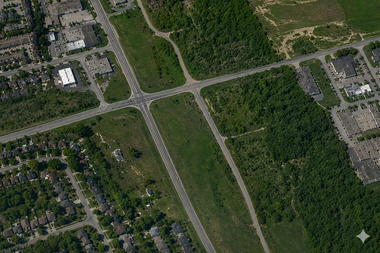
BEFORE
AFTER
🌊 Construction Monitoring
📍 Toronto, Canada
Highway Construction Monitoring
Infrastructure expansion detected over 6 months using orbital satellite intelligence.
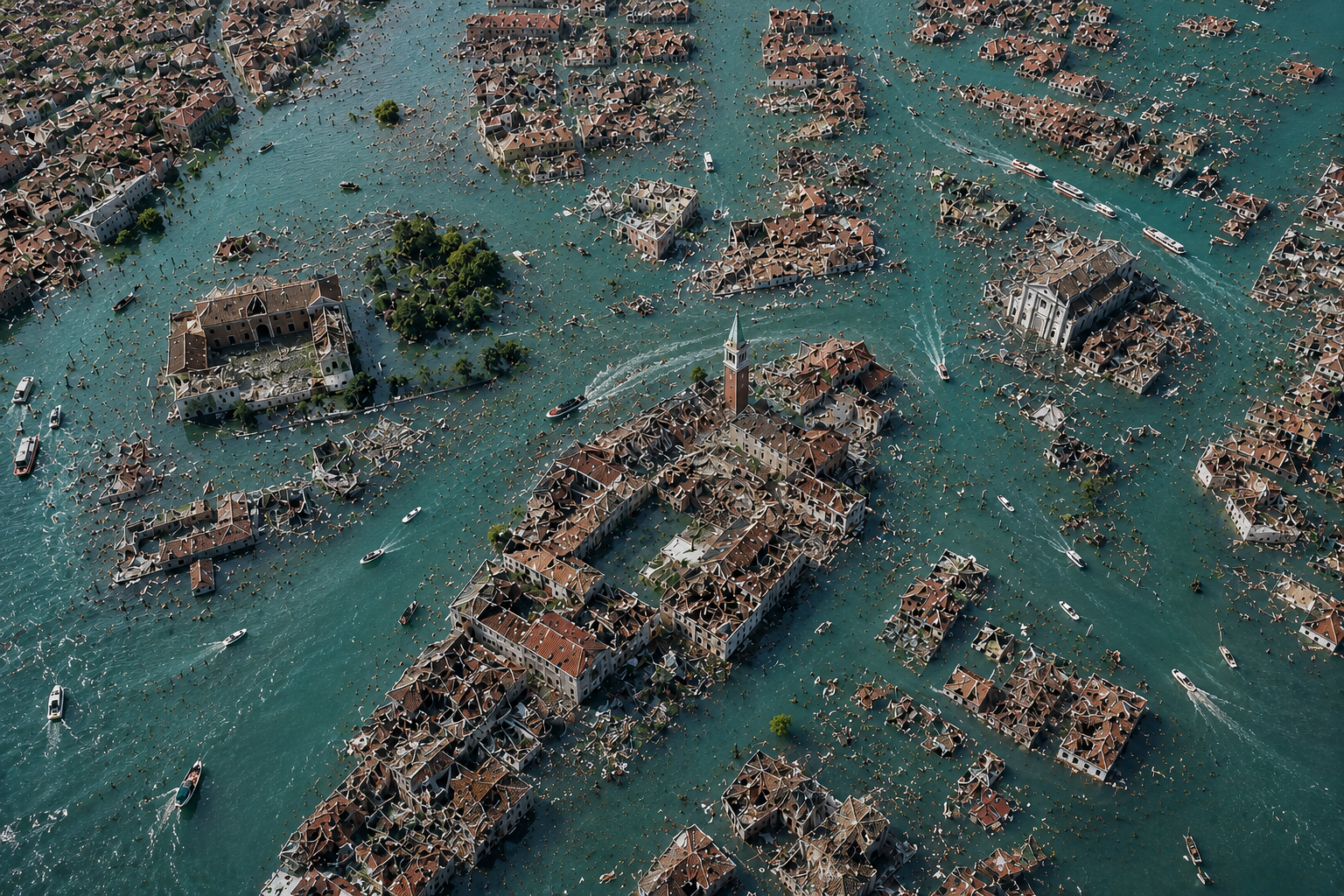
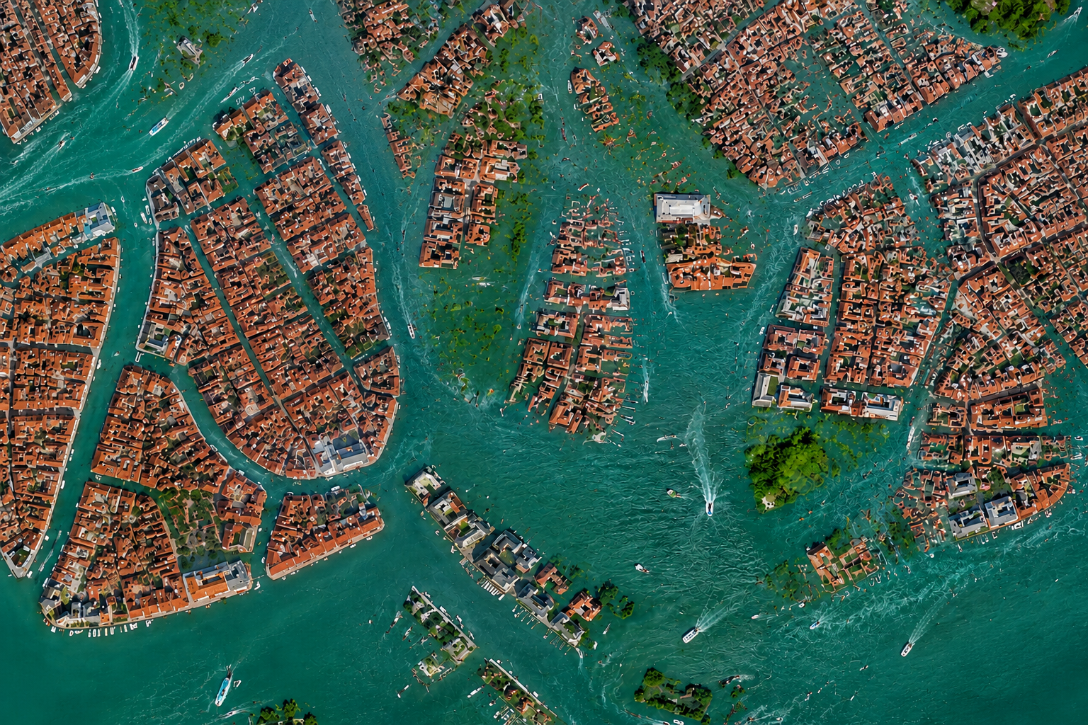
BEFORE
AFTER
🌊 Disaster Monitoring
📍 Venice, Italy
Flood Detection & Impact Analysis
Satellite imagery identified flooded regions, water spread, and infrastructure impact after severe rainfall events.
BEFORE
AFTER
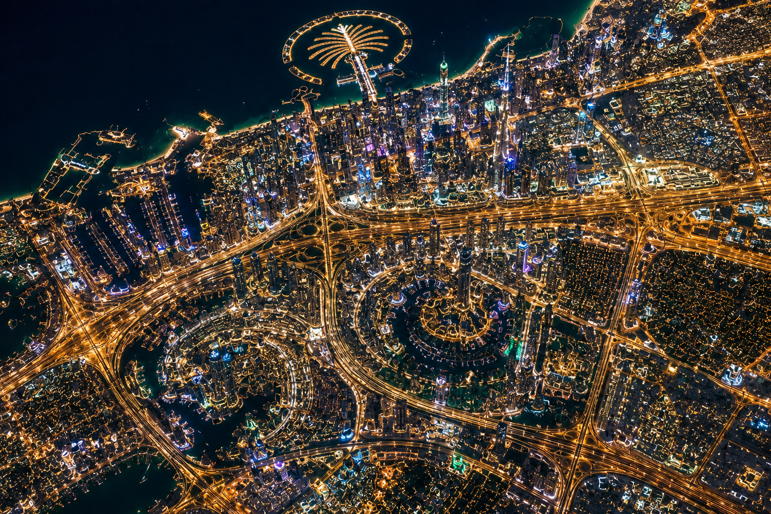
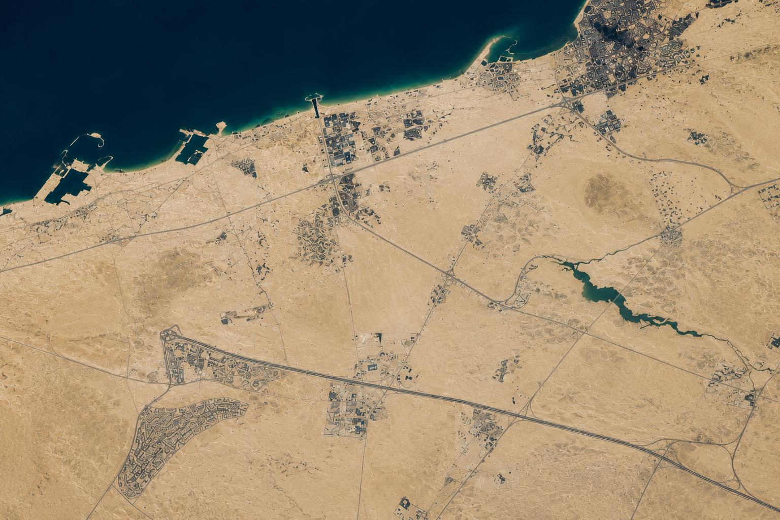
🏙️ Urban Intelligence
📍 Dubai, UAE
Urban Expansion Tracking
Analyze rapid city growth, land development, and new infrastructure projects over time.
BEFORE
AFTER
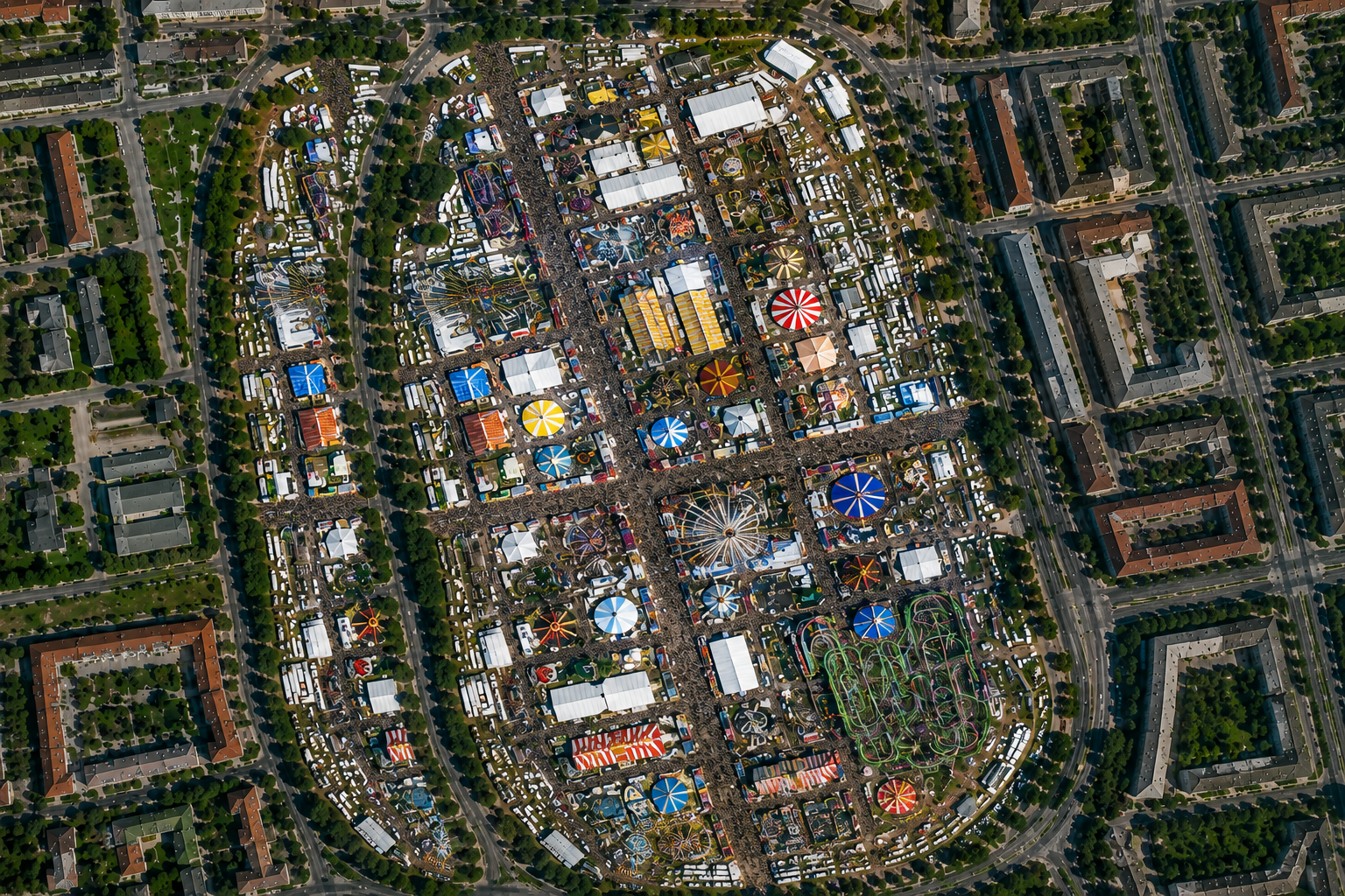
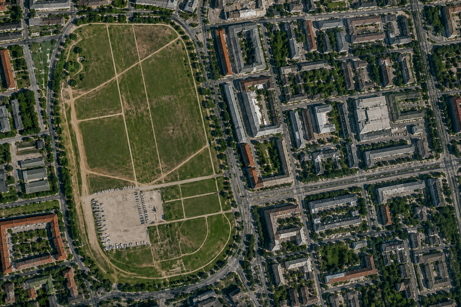
🎡 Event Detection
📍 Munich, Germany
Fair & Event Activity Detection
Compare imagery before and during large public events to identify crowd zones and temporary infrastructure.